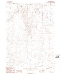
1989 Map of Jackpot
USGS Topo · Published 1989About this map
Jackpot sits directly on the border where Idaho and Nevada meet, serving as a distinct gateway community defined by its recreation and transit infrastructure. The high-desert landscape is carved by the winding course of Salmon Falls Creek and dominated to the west by the rising terrain of Browns Bench. Near the settlement, social and utility hubs are prominent, including the Golf Course, Rodeo Ground, and the Jackpot Airport. To the south, the map reveals traces of earlier transportation networks with the Old Railroad Grade following the contours near Shoshone Creek. This area illustrates the late 20th-century development of a border town, where local landmarks like the Roadside Park and Gaging Sta mark the intersection of human activity and the drainage basins of Trout Creek and Twin Springs Creek.
Find a feature on this map
22 named features on this map. Tap any name to fly to it.
Don’t see what you’re looking for? This feature index may not catch every label — zoom into the map to look around manually.
Map Details
Editions of this 1989 Jackpot Map
This is the sole edition of this map. No revisions or reprints were ever made.
Other maps of this area

1955 · Twin Falls
USGS Topo · 1:250,000

1955 · Wells
USGS Topo · 1:250,000

1957 · Contact
USGS Topo · 1:62,500

1957 · Delaplain
USGS Topo · 1:62,500

1958 · Wells
USGS Topo · 1:250,000

1958 · Twin Falls
USGS Topo · 1:250,000

1961 · Wells
USGS Topo · 1:250,000

1977 · Browns Bench South
USGS Topo · 1:24,000

1977 · Magic Hot Springs
USGS Topo · 1:24,000
1978 · Meteor
USGS Topo · 1:24,000