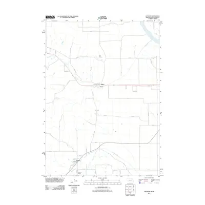
2011 Map of Jackson
USGS Topo · Published 2011About this map
The Missouri River flows along the northeastern corner of this landscape, anchoring a region defined by agricultural plains and a network of named waterways. The settlement of Jackson serves as a central hub, containing the Jackson Post Office, while Hubbard lies to the southwest with its own Hubbard Post Office. This map highlights the area's local history through well-preserved landmarks like Saint Johns Cemetery and Saint Marys Cemetery, which remain important for genealogical research.
Find a feature on this map
51 named features on this map. Tap any name to fly to it.
Don’t see what you’re looking for? This feature index may not catch every label — zoom into the map to look around manually.
Map Details
Editions of this 2011 Jackson Map
This is the sole edition of this map. No revisions or reprints were ever made.
Other maps of this area

1898 · Elk Point
USGS Topo · 1:125,000

1901 · Elk Point
USGS Topo · 1:125,000

1907 · Elk Point
USGS Topo · 1:125,000

1955 · Sioux City
USGS Topo · 1:250,000

1958 · Sioux City
USGS Topo · 1:250,000

1959 · Sioux City
USGS Topo · 1:250,000

1963 · Sioux City South
USGS Topo · 1:24,000

1963 · Sioux City North
USGS Topo · 1:24,000

1963 · Jefferson
USGS Topo · 1:24,000
1964 · Ponca
USGS Topo · 1:24,000