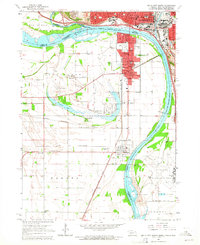
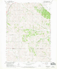
1963 Map of Sioux City South
USGS Topo · Published 1964About this map
The Missouri River and Big Sioux River converge at a bustling tri-state junction, defining the industrial and residential boundaries between Nebraska, Iowa, and South Dakota. In the early 1960s, Sioux City and South Sioux City were connected by a dense rail network including the Chicago and North Western and the Chicago Milwaukee St Paul and Pacific. The landscape reveals a transition from the urban grid to more rural developments such as Covington and Dakota City. A notable geographical feature is the oxbow of Crystal Lake, which supports recreational sites like Millis Beach and Atokad Park. The map documents significant local landmarks from the War Eagle Grave to the sprawling Sioux City Municipal Airport at the southern edge, illustrating a region shaped by both its riverine history and modern transportation infrastructure.
Find a feature on this map
66 named features on this map. Tap any name to fly to it.
Don’t see what you’re looking for? This feature index may not catch every label — zoom into the map to look around manually.
Map Details
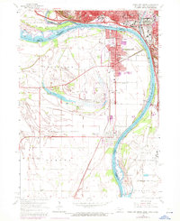
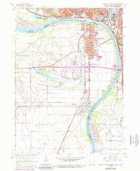
Editions of this 1963 Sioux City South Map
4 editions found
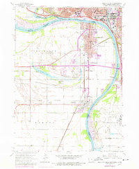
Historical Maps of Sioux City Through Time
5 maps found
Featured Locations
- Sioux City, IA
- South Sioux City, NE
- Dakota City, NE
- Dakota Precinct, NE
- Dakota Dunes, Big Sioux Township