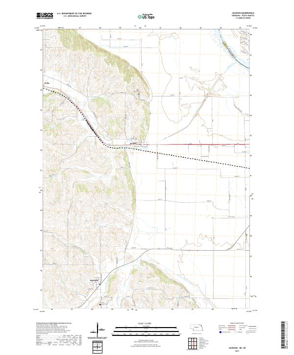
2021 Map of Jackson
USGS Topo · Published 2021About this map
Jackson and Hubbard anchor the landscape of northern Dakota County in this modern topographic study, where the plains of Nebraska meet the winding Missouri River at the South Dakota border. The terrain is defined by the sharp contrast between the flat river bottomlands to the east and the dissected loess hills to the west, featuring landmarks like Fawn Hollow. The intricate drainage patterns of Elk Creek, Pigeon Creek, and Jones Creek illustrate the historical management of the watershed, particularly evident in the channelization of the Pigeon Creek Ditch south of Hubbard.
Find a feature on this map
64 named features on this map. Tap any name to fly to it.
Don’t see what you’re looking for? This feature index may not catch every label — zoom into the map to look around manually.
Map Details
Editions of this 2021 Jackson Map
This is the sole edition of this map. No revisions or reprints were ever made.
Other maps of this area

1898 · Elk Point
USGS Topo · 1:125,000

1901 · Elk Point
USGS Topo · 1:125,000

1907 · Elk Point
USGS Topo · 1:125,000

1955 · Sioux City
USGS Topo · 1:250,000

1958 · Sioux City
USGS Topo · 1:250,000

1959 · Sioux City
USGS Topo · 1:250,000

1963 · Sioux City South
USGS Topo · 1:24,000

1963 · Sioux City North
USGS Topo · 1:24,000

1963 · Jefferson
USGS Topo · 1:24,000
1964 · Ponca
USGS Topo · 1:24,000