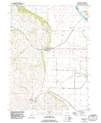
1993 Map of Jackson
USGS Topo · Published 1995About this map
Jackson and Hubbard anchor this corner of Dakota County, where the transition from the bluffs to the Missouri River floodplain defines the local geography. The landscape is marked by the presence of St Johns Cem north of Jackson and St Marys Cem near Hubbard, serving as significant markers for genealogists and local historians. This era shows a community structured by established routes like Knox Boulevard and the North Bluff Road, which follows the contours between the rolling highlands and the flat bottomlands. To the northeast, the Missouri River and Big Sioux meet near the border with Union County, South Dakota, highlighting the importance of the river system. The drainage network, including Elk Creek, Pigeon Creek, and the Pigeon Creek Ditch, reflects the ongoing efforts to manage the water levels of the surrounding agricultural lands protected by a local Levee.
Find a feature on this map
24 named features on this map. Tap any name to fly to it.
Don’t see what you’re looking for? This feature index may not catch every label — zoom into the map to look around manually.
Map Details
Editions of this 1993 Jackson Map
This is the sole edition of this map. No revisions or reprints were ever made.
Other maps of this area

1898 · Elk Point
USGS Topo · 1:125,000

1901 · Elk Point
USGS Topo · 1:125,000

1907 · Elk Point
USGS Topo · 1:125,000

1955 · Sioux City
USGS Topo · 1:250,000

1958 · Sioux City
USGS Topo · 1:250,000

1959 · Sioux City
USGS Topo · 1:250,000

1963 · Sioux City South
USGS Topo · 1:24,000

1963 · Sioux City North
USGS Topo · 1:24,000

1963 · Jefferson
USGS Topo · 1:24,000
1964 · Ponca
USGS Topo · 1:24,000