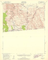
1939 Map of Jacumba
USGS Topo · Published 1958About this map
Anza Desert State Park and the high desert landscape along the border between California and Baja California define this late 1930s landscape. The settlement of Jacumba sits near the international line, serving as a key point on the San Diego and Arizona Eastern railroad. The mapping of this era reveals an economy of isolated resource extraction and infrastructure, evidenced by the Asbestos Mine, Mica Gem Mine, and a Lookout Tower positioned for survey or fire watch.
Find a feature on this map
45 named features on this map. Tap any name to fly to it.
Don’t see what you’re looking for? This feature index may not catch every label — zoom into the map to look around manually.
Map Details
Editions of this 1939 Jacumba Map
2 editions found
Other maps of this area

1915 · El Centro
USGS Topo · 1:125,000

1931 · Carrizo
USGS Topo · 1:125,000

1939 · Campo
USGS Topo · 1:62,500

1939 · Jacumba
USGS Topo · 1:62,500

1940 · Plaster City
USGS Topo · 1:62,500

1940 · Coyote Wells
USGS Topo · 1:62,500

1942 · El Centro
USGS Topo · 1:250,000

1942 · Campo
USGS Topo · 1:62,500

1942 · Carrizo Mtn
USGS Topo · 1:62,500

1942 · Jacumba
USGS Topo · 1:62,500