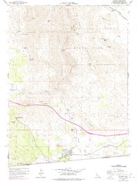
1959 Map of Jacumba
USGS Topo · Published 1978About this map
The high desert landscape of the In-Ko-Pah Mountains and Jacumba Mountains dominates this mid-century survey of the California-Mexico border. Centered on the settlement of Jacumba, the map captures the community just as modern revisions were documenting its evolving footprint, including the nearby Airport and localized infrastructure like a Trailer Park. The rugged topography is traversed by the San Diego and Arizona Eastern railroad, which navigates the steep grades of Carrizo Gorge with features like Tunnel 15 Spur and Dubber Spur. This area is defined by its critical water sources in an arid environment, from the well-known Bankhead Springs and Dos Cabezas Spring to the curiously named Arsenic Spring. Much of the northern terrain is preserved within the Anza Borrego Desert State Park, where landmarks like Mortero Palms and Piedras Grandes mark the transition from rocky peaks to desert washes.
Find a feature on this map
54 named features on this map. Tap any name to fly to it.
Don’t see what you’re looking for? This feature index may not catch every label — zoom into the map to look around manually.
Map Details
Editions of this 1959 Jacumba Map
4 editions found
Other maps of this area

1931 · Carrizo
USGS Topo · 1:125,000

1939 · Campo
USGS Topo · 1:62,500

1939 · Jacumba
USGS Topo · 1:62,500

1942 · Campo
USGS Topo · 1:62,500

1942 · Carrizo Mtn
USGS Topo · 1:62,500

1942 · Jacumba
USGS Topo · 1:62,500

1942 · Cuyapaipe
USGS Topo · 1:62,500

1950 · San Diego
USGS Topo · 1:250,000

1954 · San Diego
USGS Topo · 1:250,000

1955 · San Diego
USGS Topo · 1:250,000