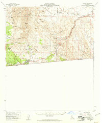
1959 Map of Jacumba
USGS Topo · Published 1961About this map
The San Diego and Arizona Eastern railway winds through the complex topography of the In-Ko-Pah Mountains and the Jacumba Mountains, tracing a route near the international border with California Baja California. This arid region, much of it protected by Anza Borrego Desert State Park, shows a landscape defined by steep canyons and sparse water sources like Dos Cabezas Spring and Sacatone Spring.
Find a feature on this map
71 named features on this map. Tap any name to fly to it.
Don’t see what you’re looking for? This feature index may not catch every label — zoom into the map to look around manually.
Map Details
Editions of this 1959 Jacumba Map
2 editions found
Other maps of this area

1915 · El Centro
USGS Topo · 1:125,000

1931 · Carrizo
USGS Topo · 1:125,000

1939 · Campo
USGS Topo · 1:62,500

1939 · Jacumba
USGS Topo · 1:62,500

1940 · Plaster City
USGS Topo · 1:62,500

1940 · Coyote Wells
USGS Topo · 1:62,500

1942 · El Centro
USGS Topo · 1:250,000

1942 · Campo
USGS Topo · 1:62,500

1942 · Carrizo Mtn
USGS Topo · 1:62,500

1942 · Jacumba
USGS Topo · 1:62,500