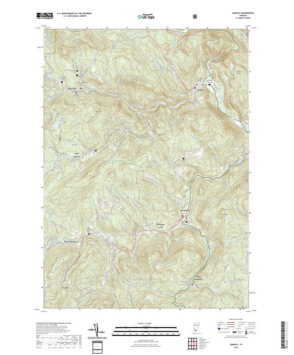
2024 Map of Jamaica
USGS Topo · Published 2024About this map
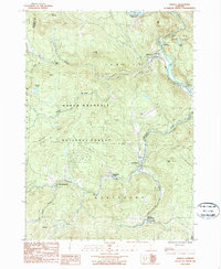
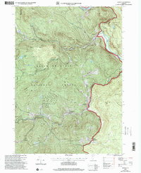
Jamaica and Wardsboro anchor this landscape within the Green Mountain National Forest, where the West River and its numerous tributaries have shaped the local settlement patterns. The map highlights a series of small villages and hamlets including Pikes Falls, West Jamaica, and the distinct clusters of Wardsboro Center and West Wardsboro. For genealogists, the map is particularly useful for its identification of numerous family and community burial grounds, such as Wilder Cem, Mundell-Bourne Cem, and Robinson Dalewood Cem. The terrain is dominated by prominent heights like The Pinnacle and Ball Mtn, which overlook the winding paths of Ball Mountain Brook and Wardsboro Brook. The inclusion of the Seventh Day Adventist Church near Pikes Falls and the small settlement of Podunk at the southern edge suggests a persistent, decentralized community structure that has characterized this part of Windham County for generations.
Find a feature on this map
103 named features on this map. Tap any name to fly to it.
Don’t see what you’re looking for? This feature index may not catch every label — zoom into the map to look around manually.
Map Details
Editions of this 2024 Jamaica Map
This is the sole edition of this map. No revisions or reprints were ever made.
Historical Maps of Podunk Through Time
3 maps found