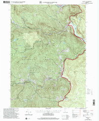
1997 Map of Jamaica
USGS Topo · Published 2000About this map
The West River carves a dramatic path through this Vermont landscape, anchored by the engineering of the Ball Mountain Reservoir and the adjacent Ball Mountain State Park. The map captures a collection of closely-knit settlements within the Green Mountain National Forest, where the topography dictated the growth of hamlets like Jamaica, Wardsboro, and West Wardsboro. These communities are connected by steep-sided valley roads that follow watercourses like Wardsboro Brook and Ball Mountain Brook.
Find a feature on this map
37 named features on this map. Tap any name to fly to it.
Don’t see what you’re looking for? This feature index may not catch every label — zoom into the map to look around manually.
Map Details
Editions of this 1997 Jamaica Map
This is the sole edition of this map. No revisions or reprints were ever made.
Other maps of this area

1889 · Wilmington
USGS Topo · 1:62,500

1891 · Wilmington
USGS Topo · 1:62,500

1891 · Brattleboro
USGS Topo · 1:62,500

1893 · Brattleboro
USGS Topo · 1:62,500

1894 · Londonderry
USGS Topo · 1:62,500

1899 · Londonderry
USGS Topo · 1:62,500

1899 · Wilmington
USGS Topo · 1:62,500

1930 · Saxtons River
USGS Topo · 1:48,000

1932 · Brattleboro
USGS Topo · 1:48,000

1933 · Saxtons River
USGS Topo · 1:62,500