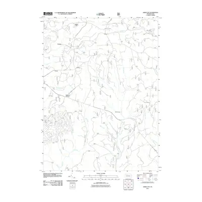
2011 Map of James City
USGS Topo · Published 2011About this map
James City and the surrounding township of Highland emerge from a landscape defined by deep valleys and the tributaries of the Allegheny National Forest area. This 2011 record documents a network of rural settlements like McKinley, Carlson, and Nansen, connected by forest roads and historic routes such as McKinley Rd and Sackett Rd. The topography is etched by numerous watercourses including Big Mill Creek, Ellithorpe Run, and Bear Creek, which carve through the terrain near Bush Hollow. Cultural landmarks such as the Hanley Fire Tower and recreational outposts like Silver Creek Camp and Ben Hur Camp signify the area's transition into a landscape of conservation and forest management. The presence of Durant City Junction at the northern edge points to the region's historical intersections of rail and road, while local labels like La Mont and Lamont suggest the enduring presence of small-scale mountain communities.
Find a feature on this map
33 named features on this map. Tap any name to fly to it.
Don’t see what you’re looking for? This feature index may not catch every label — zoom into the map to look around manually.
Map Details
Editions of this 2011 James City Map
This is the sole edition of this map. No revisions or reprints were ever made.
Other maps of this area

1934 · Kane
USGS Topo · 1:48,000

1935 · Mt. Jewett
USGS Topo · 1:48,000

1939 · Kane
USGS Topo · 1:62,500

1940 · Hallton
USGS Topo · 1:48,000

1940 · Mt. Jewett
USGS Topo · 1:62,500

1941 · Ridgway
USGS Topo · 1:62,500

1943 · Hallton
USGS Topo · 1:62,500

1944 · Ridgway
USGS Topo · 1:62,500

1957 · Warren
USGS Topo · 1:250,000

1958 · Warren
USGS Topo · 1:250,000
Featured Places
- Highland Corners, Highland Township
- James City, Highland Township
- McKinley, Highland Township
- Nansen, Highland Township
- Carlson, Highland Township