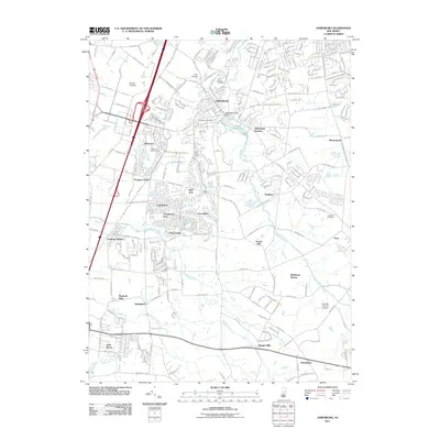
2011 Map of Jamesburg
USGS Topo · Published 2011About this map
Jamesburg serves as a central hub in this landscape, where the Manalapan Lake Dam regulates the waters of Lake Manalapan. The surrounding area is a dense patchwork of mid-century and modern residential developments including Rossmoor, Concordia, and Twin Rivers. These planned communities are interspersed with older agricultural and industrial footprints, evidenced by the presence of Wyckoffs Mills and Bergen Mills. The region's history is further anchored by several long-standing burial grounds such as Saint James Cemetery and Fernwood Cemetery.
Find a feature on this map
237 named features on this map. Tap any name to fly to it.
Don’t see what you’re looking for? This feature index may not catch every label — zoom into the map to look around manually.
Map Details
Editions of this 2011 Jamesburg Map
This is the sole edition of this map. No revisions or reprints were ever made.
Other maps of this area

1888 · Bordentown
USGS Topo · 1:62,500

1888 · New Brunswick
USGS Topo · 1:62,500

1888 · Princeton
USGS Topo · 1:62,500

1888 · Cassville
USGS Topo · 1:62,500

1893 · Bordentown
USGS Topo · 1:62,500

1893 · New Brunswick
USGS Topo · 1:62,500

1894 · Princeton
USGS Topo · 1:62,500

1894 · Cassville
USGS Topo · 1:62,500

1900 · Cassville
USGS Topo · 1:62,500

1901 · New Brunswick
USGS Topo · 1:62,500
Featured Places
- Old Bridge Township, NJ
- Monroe Township, NJ
- East Brunswick Township, NJ
- South Brunswick, NJ
- Manalapan Township, NJ