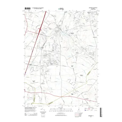
2014 Map of Jamesburg
USGS Topo · Published 2014About this map
Jamesburg serves as a central hub on this 2014 survey, where the waters of Lake Manalapan and Manalapan Brook meet a dense network of residential streets and local landmarks. The landscape reveals a mix of older borough centers and modern subdivisions like Jamesburg Gardens and Clearbrook. Several historic burying grounds, including Saint James Cem and Trinity Cem, are preserved within the developing corridor between Helmetta and Spotswood Manor.
Find a feature on this map
83 named features on this map. Tap any name to fly to it.
Don’t see what you’re looking for? This feature index may not catch every label — zoom into the map to look around manually.
Map Details
Editions of this 2014 Jamesburg Map
This is the sole edition of this map. No revisions or reprints were ever made.
Other maps of this area

1888 · Bordentown
USGS Topo · 1:62,500

1888 · New Brunswick
USGS Topo · 1:62,500

1888 · Princeton
USGS Topo · 1:62,500

1888 · Cassville
USGS Topo · 1:62,500

1893 · Bordentown
USGS Topo · 1:62,500

1893 · New Brunswick
USGS Topo · 1:62,500

1894 · Princeton
USGS Topo · 1:62,500

1894 · Cassville
USGS Topo · 1:62,500

1900 · Cassville
USGS Topo · 1:62,500

1901 · New Brunswick
USGS Topo · 1:62,500
Featured Places
- Old Bridge Township, NJ
- Monroe Township, NJ
- East Brunswick Township, NJ
- South Brunswick, NJ
- Manalapan Township, NJ