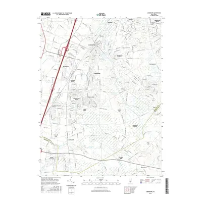
2016 Map of Jamesburg
USGS Topo · Published 2016About this map
Lake Manalapan and the surrounding borough of Jamesburg serve as the focal point for this 2016 survey of central New Jersey. The landscape is a dense network of suburban developments and older crossroad settlements, where major thoroughfares like the New Jersey Tpke and Conrail rail lines cut through the drainage basins of the Millstone River and Manalapan Brook. The transition from historic mill sites like Wyckoffs Mills and Bergen Mills to modern planned communities such as Rossmoor, Concordia, and Whittingham is evident across the terrain.
Find a feature on this map
253 named features on this map. Tap any name to fly to it.
Don’t see what you’re looking for? This feature index may not catch every label — zoom into the map to look around manually.
Map Details
Editions of this 2016 Jamesburg Map
This is the sole edition of this map. No revisions or reprints were ever made.
Other maps of this area

1888 · Bordentown
USGS Topo · 1:62,500

1888 · New Brunswick
USGS Topo · 1:62,500

1888 · Princeton
USGS Topo · 1:62,500

1888 · Cassville
USGS Topo · 1:62,500

1893 · Bordentown
USGS Topo · 1:62,500

1893 · New Brunswick
USGS Topo · 1:62,500

1894 · Princeton
USGS Topo · 1:62,500

1894 · Cassville
USGS Topo · 1:62,500

1900 · Cassville
USGS Topo · 1:62,500

1901 · New Brunswick
USGS Topo · 1:62,500
Featured Places
- Old Bridge Township, NJ
- Monroe Township, NJ
- East Brunswick Township, NJ
- South Brunswick, NJ
- Manalapan Township, NJ