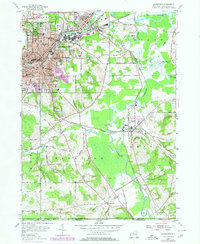
1979 Map of Jamestown
USGS Topo · Published 1980About this map
The industrial and residential growth of Jamestown and Falconer dominates the northern landscape, where the Conrail line skirts the urban edge near Moon Brook Country Club. The city's mid-century expansion is documented through a dense network of local schools, including Washington Jr High Sch, Lillian Dickson Sch, and Rogers Sch. To the south and east, the terrain transitions into the broad valleys of Conewango Creek and Cassadaga Creek, where smaller settlements like Frewsburg and Kiantone maintain their distinct character among family-named roads such as Donelson Road and Carlson Road.
Find a feature on this map
70 named features on this map. Tap any name to fly to it.
Don’t see what you’re looking for? This feature index may not catch every label — zoom into the map to look around manually.
Map Details
Editions of this 1979 Jamestown Map
This is the sole edition of this map. No revisions or reprints were ever made.
Other maps of this area

1904 · Chautaqua
USGS Topo · 1:62,500

1905 · Jamestown
USGS Topo · 1:62,500

1906 · Warren
USGS Topo · 1:62,500

1907 · Warren
USGS Topo · 1:62,500

1908 · Warren
USGS Topo · 1:62,500

1926 · Youngsville
USGS Topo · 1:62,500

1929 · Youngsville
USGS Topo · 1:62,500

1941 · Chautauqua
USGS Topo · 1:62,500

1942 · Jamestown
USGS Topo · 1:62,500

1943 · Youngsville
USGS Topo · 1:62,500