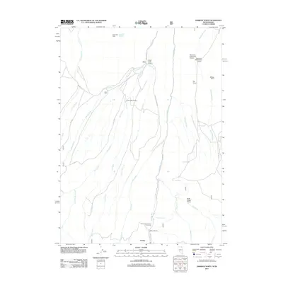
2012 Map of Jarbidge North
USGS Topo · Published 2012About this map
Jarbidge anchors the southern edge of this Nevada-Idaho border region, a landscape defined by deep drainages and remote high-country ranches. The Jarbidge River carves a central path northward, flanked by the treacherous terrain of Freighters Defeat and the isolated Big Island. This area in Elko County serves as a gateway to the wilderness, where established landmarks like Larios Ranch and Ward Ranch mark the human footprint in an otherwise dominant network of canyons including Cow Creek Canyon and Corral Creek Canyon. The map reveals a high-elevation plateau at Columbet Table and documents the primitive transportation network, such as Buck Creek Rd and Deer Creek Grades Rd, that connects these scattered outposts. Recreational sites like the Sawmill National Forest Campground and Jack Creek Camp illustrate the transition from early ranching and freighting roots to modern public land usage.
Find a feature on this map
37 named features on this map. Tap any name to fly to it.
Don’t see what you’re looking for? This feature index may not catch every label — zoom into the map to look around manually.
Map Details
Editions of this 2012 Jarbidge North Map
This is the sole edition of this map. No revisions or reprints were ever made.
Other maps of this area

1936 · Rowland
USGS Topo · 1:48,000

1940 · Rowland
USGS Topo · 1:62,500

1943 · Jarbidge
USGS Topo · 1:62,500

1945 · Jarbidge
USGS Topo · 1:62,500

1955 · Twin Falls
USGS Topo · 1:250,000

1955 · Wells
USGS Topo · 1:250,000

1958 · Wells
USGS Topo · 1:250,000

1958 · Twin Falls
USGS Topo · 1:250,000

1961 · Wells
USGS Topo · 1:250,000

1979 · Cowan Reservoir
USGS Topo · 1:24,000