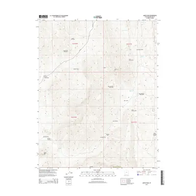
2014 Map of Jarvis Peak
USGS Topo · Published 2014About this map
Jarvis Peak dominates the center of this high-desert landscape where the Beaver Dam Mountains meet the northern edge of the Mojave Desert. This 2014 survey captures a terrain defined by complex drainage systems and seasonal washes, including Castle Cliff Wash and Cottonwood Wash, which feed several small water storage points like Mine Valley Reservoir and Quail Reservoir. A lone artery of human travel, Old US-91, cuts across the northwestern portion of the map, tracing a historic path through the arid hills.
Find a feature on this map
28 named features on this map. Tap any name to fly to it.
Don’t see what you’re looking for? This feature index may not catch every label — zoom into the map to look around manually.
Map Details
Editions of this 2014 Jarvis Peak Map
This is the sole edition of this map. No revisions or reprints were ever made.
Other maps of this area

1885 · St. George
USGS Topo · 1:250,000

1886 · Mt. Trumbull
USGS Topo · 1:250,000

1891 · St. George
USGS Topo · 1:250,000

1892 · Mt. Trumbull
USGS Topo · 1:250,000

1953 · Cedar City
USGS Topo · 1:250,000

1953 · Grand Canyon
USGS Topo · 1:250,000

1954 · Beaver Dam Mts NE
USGS Topo · 1:24,000

1954 · Wolf Hole Mtn. NW
USGS Topo · 1:24,000

1954 · Beaver Dam Mts SE
USGS Topo · 1:24,000

1954 · St. George
USGS Topo · 1:62,500