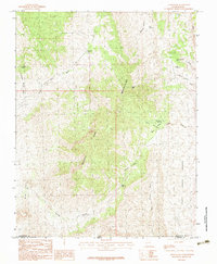
1983 Map of Jarvis Peak
USGS Topo · Published 1983About this map
The Beaver Dam Mountains dominate this 1983 topographic survey of the southwest corner of Utah. Rising to the prominent Jarvis Peak, the landscape is defined by its arid drainage systems and isolated peaks like Utah Hill Summit. The map captures the high-desert terrain where Washington County meets the Arizona border, highlighting the critical importance of water management in this environment. Numerous man-made catchments such as Laub Reservoir, Quail Reservoir, and Mine Valley Reservoir are scattered across the slopes, supporting land use indicated by labels like the Lambing Grounds and Blakes. Transport through these heights is marked by the Buldog Pass, while complex drainages including Wittwer Canyon and Mine Valley Wash cut through the sedimentary layers of the White Hills. This provisional edition provides a clear view of the natural and engineered infrastructure of the basin-and-range country before later development.
Find a feature on this map
24 named features on this map. Tap any name to fly to it.
Don’t see what you’re looking for? This feature index may not catch every label — zoom into the map to look around manually.
Map Details
Editions of this 1983 Jarvis Peak Map
This is the sole edition of this map. No revisions or reprints were ever made.
Other maps of this area

1885 · St. George
USGS Topo · 1:250,000

1886 · Mt. Trumbull
USGS Topo · 1:250,000

1891 · St. George
USGS Topo · 1:250,000

1892 · Mt. Trumbull
USGS Topo · 1:250,000

1953 · Cedar City
USGS Topo · 1:250,000

1953 · Grand Canyon
USGS Topo · 1:250,000

1954 · Beaver Dam Mts NE
USGS Topo · 1:24,000

1954 · Wolf Hole Mtn. NW
USGS Topo · 1:24,000

1954 · Beaver Dam Mts SE
USGS Topo · 1:24,000

1954 · St. George
USGS Topo · 1:62,500