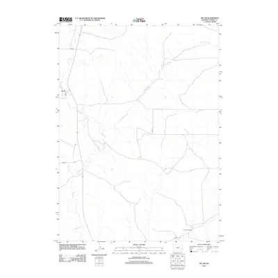
2012 Map of Jay Em
USGS Topo · Published 2012About this map
Jay Em occupies a prominent position in this corner of Goshen County, situated along the upper reaches of Rawhide Creek. The landscape is defined by its drainage patterns, notably the winding paths of Red Cloud Slough and Muskrat Creek which cut through the high plains. The settlement pattern is sparse, reflecting a ranching heritage where named locations like Sixmile Creek Ranch serve as primary landmarks in an area dominated by open range and seasonal waterways. A network of county roads, including Co RD-7 and Co RD-22, provides the essential infrastructure for this rural community. The presence of J M Creek and Sixmile Creek further illustrates the significance of water resources in shaping the local geography and land use in this part of eastern Wyoming.
Find a feature on this map
12 named features on this map. Tap any name to fly to it.
Don’t see what you’re looking for? This feature index may not catch every label — zoom into the map to look around manually.
Map Details
Editions of this 2012 Jay Em Map
This is the sole edition of this map. No revisions or reprints were ever made.
Other maps of this area

1896 · Patrick
USGS Topo · 1:125,000

1954 · Torrington
USGS Topo · 1:250,000

1958 · Torrington
USGS Topo · 1:250,000

1974 · Spoon Butte SW
USGS Topo · 1:24,000
1974 · Jay Em NW
USGS Topo · 1:24,000

1974 · Jay Em
USGS Topo · 1:24,000

1974 · Rawhide Buttes East
USGS Topo · 1:24,000
1977 · Red Cloud Creek West
USGS Topo · 1:24,000

1977 · Hileman Draw
USGS Topo · 1:24,000

1977 · Prairie Center
USGS Topo · 1:24,000