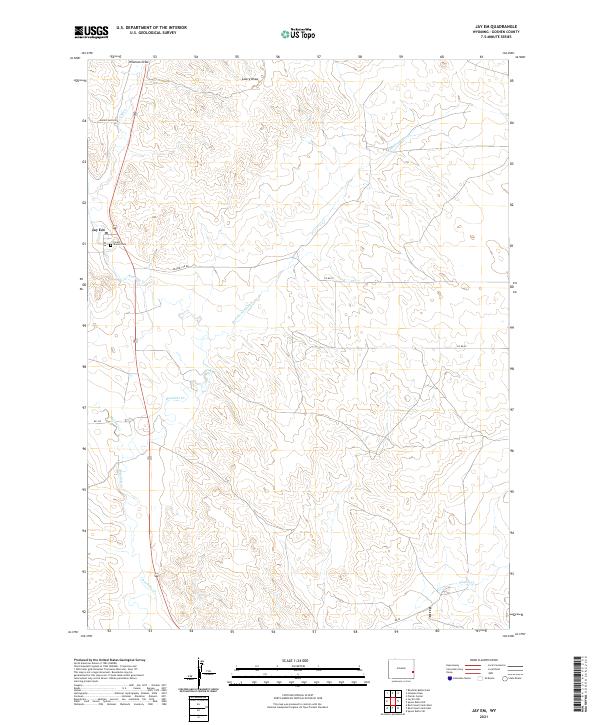
2021 Map of Jay Em
USGS Topo · Published 2021About this map
Jay Em serves as the focal point of this high-plains landscape, situated along the course of Rawhide Cr. The settlement is marked by its Po and the nearby Forest Mound Cem, providing a clear record of local genealogy and land tenure in Goshen County. The terrain is defined by an intricate network of ephemeral watercourses and drainages, including Hileman Draw, Lowry Draw, and the uniquely named Red Cloud Slough. Human presence is further etched into the landscape by a grid of rural routes such as Harris Ranch Rd and Prairie Ctr Rd, which connect remote ranching operations. The presence of Sixmile Cr in the southeast corner and Muskrat Cr to the west highlights the importance of seasonal water management in this Wyoming cattle country.
Find a feature on this map
19 named features on this map. Tap any name to fly to it.
Don’t see what you’re looking for? This feature index may not catch every label — zoom into the map to look around manually.
Map Details
Editions of this 2021 Jay Em Map
This is the sole edition of this map. No revisions or reprints were ever made.
Other maps of this area

1896 · Patrick
USGS Topo · 1:125,000

1954 · Torrington
USGS Topo · 1:250,000

1958 · Torrington
USGS Topo · 1:250,000

1974 · Spoon Butte SW
USGS Topo · 1:24,000
1974 · Jay Em NW
USGS Topo · 1:24,000

1974 · Jay Em
USGS Topo · 1:24,000

1974 · Rawhide Buttes East
USGS Topo · 1:24,000
1977 · Red Cloud Creek West
USGS Topo · 1:24,000

1977 · Hileman Draw
USGS Topo · 1:24,000

1977 · Prairie Center
USGS Topo · 1:24,000