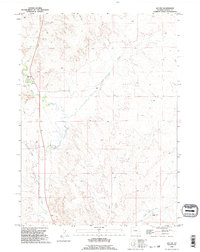
1990 Map of Jay Em
USGS Topo · Published 1995About this map
Jay Em serves as the central hub of this eastern Wyoming landscape, situated along the historic route of Ft. Laramie Rd. The settlement's proximity to Rawhide Creek and a nearby Cemetery provides a focal point for genealogical research in this part of Goshen County. The terrain is defined by a network of drainage systems and intermittent water features, including Red Cloud Slough, Lowry Draw, and Muskrat Creek.
Find a feature on this map
14 named features on this map. Tap any name to fly to it.
Don’t see what you’re looking for? This feature index may not catch every label — zoom into the map to look around manually.
Map Details
Editions of this 1990 Jay Em Map
This is the sole edition of this map. No revisions or reprints were ever made.
Other maps of this area

1896 · Patrick
USGS Topo · 1:125,000

1954 · Torrington
USGS Topo · 1:250,000

1958 · Torrington
USGS Topo · 1:250,000

1974 · Spoon Butte SW
USGS Topo · 1:24,000
1974 · Jay Em NW
USGS Topo · 1:24,000

1974 · Jay Em
USGS Topo · 1:24,000

1974 · Rawhide Buttes East
USGS Topo · 1:24,000
1977 · Red Cloud Creek West
USGS Topo · 1:24,000

1977 · Hileman Draw
USGS Topo · 1:24,000

1977 · Prairie Center
USGS Topo · 1:24,000