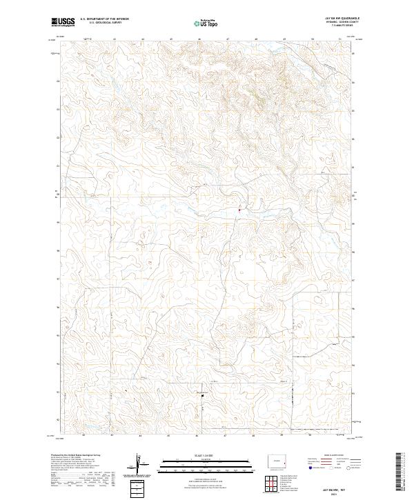
2021 Map of Jay Em NW
USGS Topo · Published 2021About this map
Red Cloud Cem stands as a quiet local landmark in this corner of Goshen County, situated near the headwaters of Red Cloud Cr. The landscape is defined by the winding paths of several intermittent waterways, including Muskrat Cr, Cottonwood Cr, and Rawhide Cr in the northern reaches. This rural expanse is mapped with a network of local roads such as Harris Ranch Rd, Co Rd 15, and Co Rd 12, which trace the section lines across townships T28N and T29N. The distribution of these ranch roads and the placement of the cemetery suggest a long history of family-run agriculture and remote settlement in the high plains of eastern Wyoming.
Find a feature on this map
17 named features on this map. Tap any name to fly to it.
Don’t see what you’re looking for? This feature index may not catch every label — zoom into the map to look around manually.
Map Details
Editions of this 2021 Jay Em NW Map
This is the sole edition of this map. No revisions or reprints were ever made.
Other maps of this area

1896 · Patrick
USGS Topo · 1:125,000

1896 · Hartville
USGS Topo · 1:125,000

1901 · Hartville
USGS Topo · 1:125,000

1950 · Casebier Hill
USGS Topo · 1:24,000

1951 · Moore Spring
USGS Topo · 1:24,000

1954 · Torrington
USGS Topo · 1:250,000

1958 · Torrington
USGS Topo · 1:250,000
1974 · Jay Em NW
USGS Topo · 1:24,000

1974 · Jay Em
USGS Topo · 1:24,000

1974 · Rawhide Buttes East
USGS Topo · 1:24,000