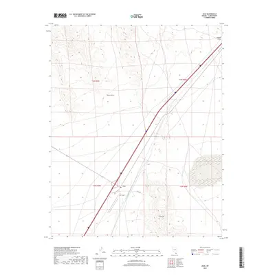
2018 Map of Jean
USGS Topo · Published 2018About this map
The high desert landscape of Ivanpah Valley defines this portion of the Mojave Desert, where the small settlement of Jean serves as a primary waypoint along the transit corridor between Southern California and Las Vegas. This late-2010s survey captures the region's reliance on major transportation arteries, with the Interstate and S Las Vegas Blvd bisecting the arid terrain. The map details the local aviation infrastructure at the Jean Airport and the specialized access provided by Prison Rd, reflecting the community's role in public service and regional logistics.
Find a feature on this map
12 named features on this map. Tap any name to fly to it.
Don’t see what you’re looking for? This feature index may not catch every label — zoom into the map to look around manually.
Map Details
Editions of this 2018 Jean Map
This is the sole edition of this map. No revisions or reprints were ever made.
Other maps of this area

1910 · Ivanpah
USGS Topo · 1:250,000

1912 · Ivanpah
USGS Topo · 1:250,000

1942 · Ivanpah
USGS Topo · 1:250,000

1947 · Kingman
USGS Topo · 1:250,000

1948 · Kingman
USGS Topo · 1:250,000

1954 · Kingman
USGS Topo · 1:250,000

1955 · Kingman
USGS Topo · 1:250,000

1955 · Roach Lake
USGS Topo · 1:62,500

1958 · Kingman
USGS Topo · 1:250,000

1960 · Kingman
USGS Topo · 1:250,000