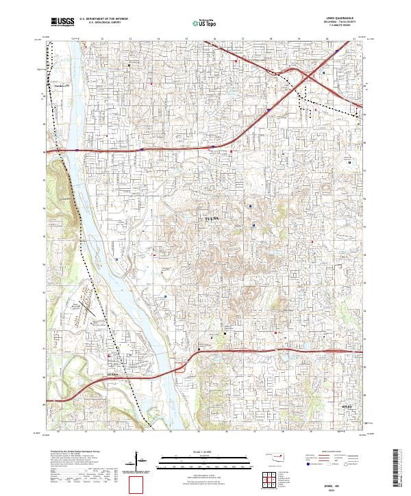
2022 Map of Jenks
USGS Topo · Published 2022About this map
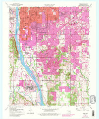
The Arkansas River carves a path through the heart of the Tulsa metropolitan area, defining the border between growing suburban centers and established urban neighborhoods. This 2022 survey captures the modern landscape of Tulsa, Jenks, and Bixby, where high-density commercial developments like Woodland Hills Mall contrast with the natural elevation of Turkey Mountain. The presence of Oral Roberts University and the striking City of Faith complex anchors the southern portion of the city, while Tulsa Riverside Airport serves as a major transportation hub along the riverbanks.
Find a feature on this map
44 named features on this map. Tap any name to fly to it.
Don’t see what you’re looking for? This feature index may not catch every label — zoom into the map to look around manually.
Map Details
Editions of this 2022 Jenks Map
This is the sole edition of this map. No revisions or reprints were ever made.