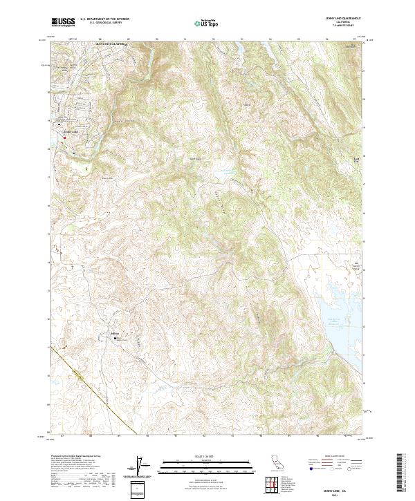
2021 Map of Jenny Lind
USGS Topo · Published 2021About this map
Jenny Lind and the sprawling residential development of Rancho Calaveras occupy the northwestern corner of this landscape, where the Calaveras River winds through the foothills. The area preserves significant fraternal history at the Jenny Lind International Order of Odd Fellows Cemetery, while the southern settlement of Milton is home to the Milton Masonic Cemetery. Between these small centers, the terrain transitions into the steep relief of Gopher Ridge and the Bear Mountains. Water management is a defining characteristic of this region, evidenced by the extensive Salt Spring Valley Reservoir, Old McCormick Reservoir, and historical infrastructure like the S Gultch Ditch and Rock Cr Ditch. Further east, isolated locations such as Siberia and Lost City sit among the network of gulches and creeks that drain the lower Sierra Nevada slopes.
Find a feature on this map
68 named features on this map. Tap any name to fly to it.
Don’t see what you’re looking for? This feature index may not catch every label — zoom into the map to look around manually.
Map Details
Editions of this 2021 Jenny Lind Map
This is the sole edition of this map. No revisions or reprints were ever made.
Other maps of this area

1889 · Jackson
USGS Topo · 1:125,000

1892 · Jackson
USGS Topo · 1:125,000

1897 · Jackson
USGS Topo · 1:125,000

1902 · Jackson
USGS Topo · 1:125,000

1915 · Trigo
USGS Topo · 1:31,680

1916 · Bachelor Valley
USGS Topo · 1:31,680

1916 · Copperopolis
USGS Topo · 1:62,500

1942 · Farmington
USGS Topo · 1:62,500

1942 · Copperopolis
USGS Topo · 1:62,500

1944 · Valley Springs
USGS Topo · 1:62,500