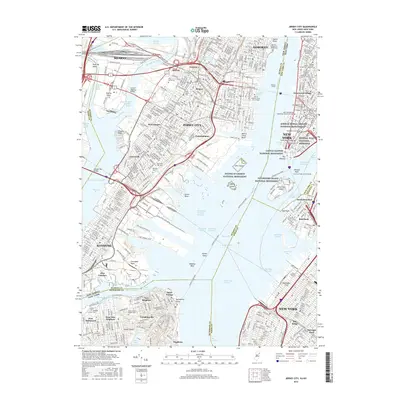
2016 Map of Jersey City
USGS Topo · Published 2016About this map
The Statue of Liberty National Monument stands at the center of this 2016 survey, a landmark situated between the maritime corridors of the Upper Bay and the Hudson River. The map meticulously details the dense urban convergence of New Jersey and New York, illustrating how the waterfronts of Jersey City, Hoboken, and Bayonne interact with the financial and historical core of New York. Beyond the skyline, the map reveals deep-seated community anchors like the African Burial Ground National Monument and the Federal Hall National Memorial in Lower Manhattan. On Staten Island, the grounds of Sailors Snug Harbor Cem and Staten Island Cem provide genealogical context, while major transit arteries like the Holland Tunnel and Pulaski Skyway bind the tri-state region together across the Hackensack River and Newark Bay.
Find a feature on this map
108 named features on this map. Tap any name to fly to it.
Don’t see what you’re looking for? This feature index may not catch every label — zoom into the map to look around manually.
Map Details
Editions of this 2016 Jersey City Map
This is the sole edition of this map. No revisions or reprints were ever made.
Other maps of this area

1888 · Paterson
USGS Topo · 1:62,500

1889 · Brooklyn
USGS Topo · 1:62,500

1891 · Brooklyn
USGS Topo · 1:62,500

1891 · Harlem
USGS Topo · 1:62,500

1892 · Paterson
USGS Topo · 1:62,500

1897 · Harlem
USGS Topo · 1:62,500

1897 · Brooklyn
USGS Topo · 1:62,500

1898 · Harlem
USGS Topo · 1:62,500

1898 · Staten Island
USGS Topo · 1:62,500

1898 · Brooklyn
USGS Topo · 1:62,500