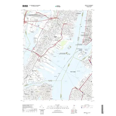
2019 Map of Jersey City
USGS Topo · Published 2019About this map
Jersey City and lower Manhattan sit at the center of this 2019 survey, defined by the dense urban intersection of the Hudson River and Upper Bay. The map documents a modern landscape of significant memorial sites, including the Statue of Liberty National Monument on Liberty Island and the African Burial Ground National Monument in the heart of New York. The industrial legacy of the waterfront is visible in features like the Morris Canal Basin and the extensive terminal channels such as Claremont Terminal Channel.
Find a feature on this map
110 named features on this map. Tap any name to fly to it.
Don’t see what you’re looking for? This feature index may not catch every label — zoom into the map to look around manually.
Map Details
Editions of this 2019 Jersey City Map
This is the sole edition of this map. No revisions or reprints were ever made.
Other maps of this area

1888 · Paterson
USGS Topo · 1:62,500

1889 · Brooklyn
USGS Topo · 1:62,500

1891 · Brooklyn
USGS Topo · 1:62,500

1891 · Harlem
USGS Topo · 1:62,500

1892 · Paterson
USGS Topo · 1:62,500

1897 · Harlem
USGS Topo · 1:62,500

1897 · Brooklyn
USGS Topo · 1:62,500

1898 · Harlem
USGS Topo · 1:62,500

1898 · Staten Island
USGS Topo · 1:62,500

1898 · Brooklyn
USGS Topo · 1:62,500