Loading...
Loading map...2024 Map of Jersey
USGS Topo · Published 2024About this map
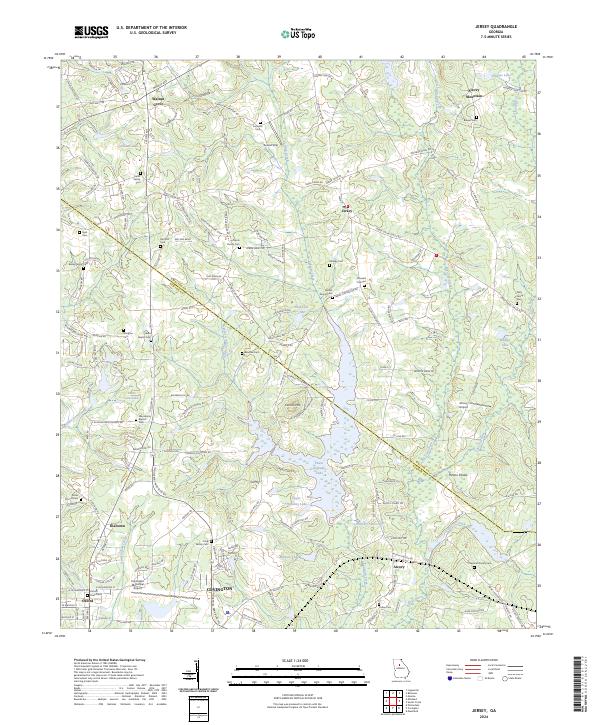
Cornish Creek and its extensive reservoir system dominate the central topography of this Walton and Newton County borderland. The landscape is characterized by a series of significant water bodies, including Upper Williams Lake, Lower Williams Lake, and the broad reaches of the Cornish Cr Reservoir. These waterways are flanked by notable elevations such as Alcovy Mountain to the northeast and Cornish Mtn overlooking the reservoir.
Find a feature on this map
179 named features on this map. Tap any name to fly to it.
Don’t see what you’re looking for? This feature index may not catch every label — zoom into the map to look around manually.
Map Details
Date Portrayed2024
Date Published2024
PublisherU.S. Geological Survey
Map TypeTopographic
Scale1:24000
Physical Dimensions24 x 29 inches
Editions of this 2024 Jersey Map
This is the sole edition of this map. No revisions or reprints were ever made.
Historical Maps of Alcovy Through Time
Featured Locations
Source Details
SourceU.S. Geological Survey
CopyrightPublic Domain