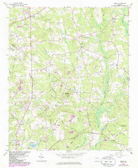
1964 Map of Jersey
USGS Topo · Published 1988About this map
The boundary between Walton and Newton counties bisects this Georgia landscape, defined by the winding course of the Alcovy River and its numerous tributaries. Small rural communities like Walnut Grove, Jersey, and Flint Hill anchor the terrain, which is characterized by a mix of wooded ridges and small-scale agriculture. The geography is punctuated by significant elevations such as Cornish Mountain and Alcovy Mountain, while the southern portion reflects mid-century infrastructure developments, including the Covington Municipal Airport and the Covington Reservoir.
Find a feature on this map
61 named features on this map. Tap any name to fly to it.
Don’t see what you’re looking for? This feature index may not catch every label — zoom into the map to look around manually.
Map Details
Editions of this 1964 Jersey Map
3 editions found
Other maps of this area

1896 · Monroe
USGS Topo · 1:125,000

1953 · Athens
USGS Topo · 1:250,000

1958 · Athens
USGS Topo · 1:250,000

1959 · Athens
USGS Topo · 1:250,000

1963 · Athens
USGS Topo · 1:250,000
1964 · Loganville
USGS Topo · 1:24,000

1964 · Between
USGS Topo · 1:24,000

1964 · Monroe
USGS Topo · 1:24,000

1964 · Porterdale
USGS Topo · 1:24,000

1964 · Covington
USGS Topo · 1:24,000