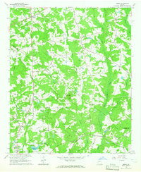
1964 Map of Jersey
USGS Topo · Published 1966About this map
The rolling Piedmont landscape of Walton and Newton counties comes into focus in the mid-1960s, defined by its intricate network of drainage ways including Cornish Creek and the Alcovy River. Several long-standing agrarian settlements are recorded here, from the northern community of Walnut Grove to the town of Jersey and the edges of Oxford in the southwest. The terrain is punctuated by distinctive rises like Cornish Mountain and Alcovy Mountain, while the presence of Quarries and various family-named burial grounds like Carter Cem, Brodnax Cem, and Mobley Cem provides significant data for genealogists tracing local landownership. The infrastructure of the era is evident in the Covington Municipal Airport and the expansion of rural routes such as Georgia 81, marking the transition between traditional farming communities and modern regional development.
Find a feature on this map
65 named features on this map. Tap any name to fly to it.
Don’t see what you’re looking for? This feature index may not catch every label — zoom into the map to look around manually.
Map Details
Editions of this 1964 Jersey Map
3 editions found
Other maps of this area

1896 · Monroe
USGS Topo · 1:125,000

1953 · Athens
USGS Topo · 1:250,000

1958 · Athens
USGS Topo · 1:250,000

1959 · Athens
USGS Topo · 1:250,000

1963 · Athens
USGS Topo · 1:250,000
1964 · Loganville
USGS Topo · 1:24,000

1964 · Between
USGS Topo · 1:24,000

1964 · Monroe
USGS Topo · 1:24,000

1964 · Porterdale
USGS Topo · 1:24,000

1964 · Covington
USGS Topo · 1:24,000