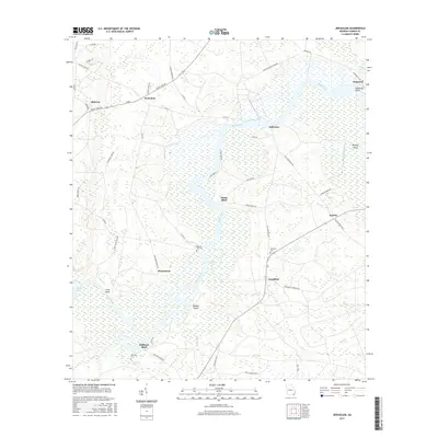
2017 Map of Jerusalem
USGS Topo · Published 2017About this map
The Satilla River meanders across this landscape, defining the character of Camden County with its complex system of islands and high ground. Settlements like Jerusalem and Jefferson sit along the winding watercourse, connected by rural routes such as Burnt Fort Rd and Old National Hwy. The river's influence is evident in the naming of prominent landings and lookouts, including Clarks Bluff, Bullhead Bluff, and Long Bluff.
Find a feature on this map
58 named features on this map. Tap any name to fly to it.
Don’t see what you’re looking for? This feature index may not catch every label — zoom into the map to look around manually.
Map Details
Editions of this 2017 Jerusalem Map
This is the sole edition of this map. No revisions or reprints were ever made.
Other maps of this area

1917 · Nahunta
USGS Topo · 1:62,500

1917 · Boulogne
USGS Topo · 1:62,500

1918 · Nahunta
USGS Topo · 1:62,500

1918 · Bladen
USGS Topo · 1:62,500

1918 · Kingsland
USGS Topo · 1:62,500

1919 · Boulogne
USGS Topo · 1:62,500

1939 · Bladen
USGS Topo · 1:62,500

1946 · Brunswick
USGS Topo · 1:250,000

1948 · Jacksonville
USGS Topo · 1:250,000

1948 · Brunswick
USGS Topo · 1:250,000