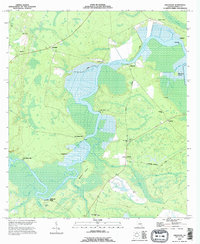
1993 Map of Jerusalem
USGS Topo · Published 1995About this map
The Satilla River winds through this coastal Georgia landscape, defining the borders of Monfort Island and passing several historic crossing points and river landings. During this era, the riverbank was dotted with small settlements and industrial markers such as Owens Ferry, Clarks Bluff, and Bullhead Bluff. The interior reflects a deep-rooted local history, with familial names preserved in places like Jim Baileys Mill and John Baileys Mill. To the east, the Old National Highway provides a terrestrial backbone for the community of Tompkins, where the Tompkins Cem and New Hope Ch serve as local landmarks. The presence of features like Hells Gate along the water and the Refuge Camp to the north highlight the varied use of this wetland-dominated environment in Camden County.
Find a feature on this map
36 named features on this map. Tap any name to fly to it.
Don’t see what you’re looking for? This feature index may not catch every label — zoom into the map to look around manually.
Map Details
Editions of this 1993 Jerusalem Map
This is the sole edition of this map. No revisions or reprints were ever made.
Other maps of this area

1917 · Nahunta
USGS Topo · 1:62,500

1917 · Boulogne
USGS Topo · 1:62,500

1918 · Nahunta
USGS Topo · 1:62,500

1918 · Bladen
USGS Topo · 1:62,500

1918 · Kingsland
USGS Topo · 1:62,500

1919 · Boulogne
USGS Topo · 1:62,500

1939 · Bladen
USGS Topo · 1:62,500

1946 · Brunswick
USGS Topo · 1:250,000

1948 · Jacksonville
USGS Topo · 1:250,000

1948 · Brunswick
USGS Topo · 1:250,000