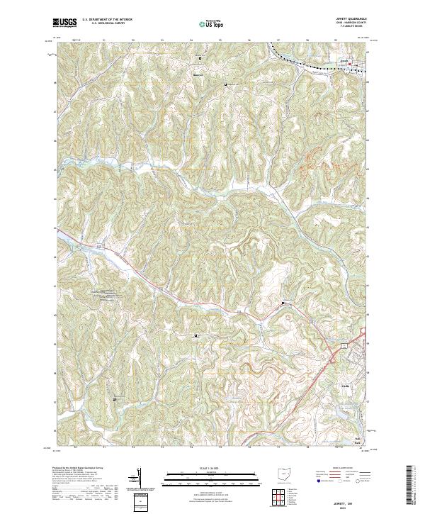
2023 Map of Jewett
USGS Topo · Published 2023About this map
Logans Summit and Chestnut Ridge define the ridgeline topography of this Harrison County landscape, where deep valleys are carved by Clear Fork and Standingstone Fork. The settlement pattern is anchored by the village of Jewett, with smaller communities like Hanover and Oak Park situated along the winding rural road network. Local family and community history is preserved in numerous burial sites, including the Ridgeview Cem and Hines Cem, as well as the uniquely named Infirmary Cem south of Jewett. Modern industrial footprints are visible through the CONSOL Energy Pond, while recreational and water management features like Sally Buffalo Lake Number Two and the Harris Pond Dam near Cadiz mark the southeastern reaches of the quadrangle.
Find a feature on this map
89 named features on this map. Tap any name to fly to it.
Don’t see what you’re looking for? This feature index may not catch every label — zoom into the map to look around manually.
Map Details
Editions of this 2023 Jewett Map
This is the sole edition of this map. No revisions or reprints were ever made.
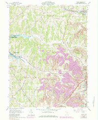
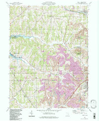
Historical Maps of Cadiz Through Time
3 maps found