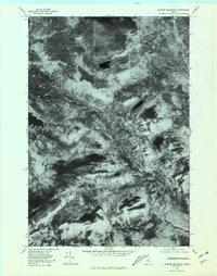
1978 Map of Jo-Mary Mountain
USGS Topo · Published 1981About this map
Jo-Mary Mountain and the high timberlands of Piscataquis County are documented here through high-resolution orthophotography from the late 1970s. This orthophotoquad provides a clear visual record of the forest canopy and logging access routes as they existed during this era of industrial forestry. The East Branch Pleasant River cuts a prominent diagonal path through the center of the sheet, while several remote water bodies, including Johnston Pond and B Pond, dot the upland landscape. The imagery captures the varied terrain of the region, from the steep slopes of Cedar Mountain to the peaks of Big Wilkie Mountain and Little Wilkie Mountain. Because this is an aerial-derived image rather than a traditional line map, it offers researchers a direct look at the ground cover and land use patterns of the Maine woods before more recent commercial shifts.
Find a feature on this map
7 named features on this map. Tap any name to fly to it.
Don’t see what you’re looking for? This feature index may not catch every label — zoom into the map to look around manually.
Map Details
Editions of this 1978 Jo-Mary Mountain Map
This is the sole edition of this map. No revisions or reprints were ever made.
Other maps of this area

1940 · Sebec
USGS Topo · 1:48,000

1943 · Sebec
USGS Topo · 1:62,500

1947 · Schoodic
USGS Topo · 1:62,500

1949 · Schoodic
USGS Topo · 1:62,500

1951 · Norcross
USGS Topo · 1:62,500

1952 · Jo-Mary Mountain
USGS Topo · 1:62,500

1954 · Millinocket
USGS Topo · 1:250,000

1958 · Millinocket
USGS Topo · 1:250,000

1960 · Millinocket
USGS Topo · 1:250,000
1978 · Silver Lake
USGS Topo · 1:24,000