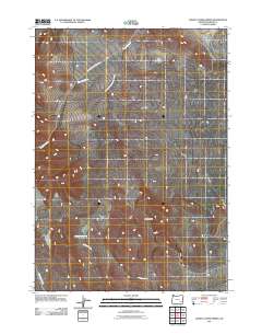
2011 Map of Johnny Creek Spring
USGS Topo · Published 2011About this map
Johnny Creek Spring sits at the heart of this high desert landscape in Malheur County, marking a vital water source in an arid expanse. The terrain is defined by the elevation of Cone Ridge, which divides the drainage systems of the north and south. In the northern section, the Ryegrass Creek network, including the South Fork Ryegrass Creek, creates a distinct hydrological pattern alongside the N Fork Ryegrass Creek Rd. To the south, the land slopes toward Johnny Creek and Palomino Creek. This survey captures the essential geography of the Oregon backcountry as it appeared in the early 21st century, documenting the remote access roads and seasonal watercourses that sustain life and livestock in the region.
Find a feature on this map
8 named features on this map. Tap any name to fly to it.
Don’t see what you’re looking for? This feature index may not catch every label — zoom into the map to look around manually.
Map Details
Editions of this 2011 Johnny Creek Spring Map
This is the sole edition of this map. No revisions or reprints were ever made.
Other maps of this area

1955 · Jordan Valley
USGS Topo · 1:250,000

1955 · Burns
USGS Topo · 1:250,000

1955 · Adel
USGS Topo · 1:250,000

1955 · Boise
USGS Topo · 1:250,000

1957 · Adel
USGS Topo · 1:250,000

1957 · Jordan Valley
USGS Topo · 1:250,000

1958 · Burns
USGS Topo · 1:250,000

1958 · Boise
USGS Topo · 1:250,000

1958 · Adel
USGS Topo · 1:250,000

1958 · Jordan Valley
USGS Topo · 1:250,000