
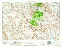
1958 Map of Jordan Valley
USGS Topo · Published 1958About this map
Jordan Valley and the surrounding high desert of Malheur County, Oregon, and Owyhee County, Idaho, are defined by a complex network of ranching outposts and dramatic volcanic geology. This mid-century survey highlights the deep incision of the Owyhee Canyon and the surrounding Lava flows that dictated settlement patterns. While ranching remains the primary footprint, evidenced by the Monastary Ranch, Castle Ranch, and Flying H Ranch, industrial presence is marked by the South Mountain Mining Company and the Highway Maintenance Shop. Significant water management features like the Antelope Reservoir and Jumper Basin Reservoir illustrate the area's dependence on irrigation and seasonal water sources. The map also delineates the northern portion of the Duck Valley Indian Reservation, underscoring the jurisdictional layers of this borderland region during the 1950s.
Find a feature on this map
66 named features on this map. Tap any name to fly to it.
Don’t see what you’re looking for? This feature index may not catch every label — zoom into the map to look around manually.
Map Details
Editions of this 1958 Jordan Valley Map
2 editions found
Other maps of this area

1882 · Paradise
USGS Topo · 1:250,000

1886 · Disaster
USGS Topo · 1:250,000

1892 · Mountain Home
USGS Topo · 1:125,000

1892 · Bisuka
USGS Topo · 1:125,000

1892 · Silver City
USGS Topo · 1:125,000

1893 · Mountain Home
USGS Topo · 1:125,000

1893 · Paradise
USGS Topo · 1:250,000

1893 · Disaster
USGS Topo · 1:250,000

1894 · Bisuka
USGS Topo · 1:125,000

1894 · Silver City
USGS Topo · 1:125,000