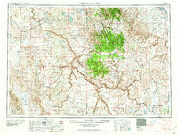
1958 Map of Jordan Valley
USGS Topo · Published 1958About this map
Rome and Burns Junction serve as small hubs in this high-desert landscape of Malheur and Owyhee counties during the mid-1950s. The region is defined by volcanic features like lava flows and isolated peaks including War Eagle Mountain and Jackies Butte. Ranching and land management are evident through scattered outposts like the Bowden Ranch and Battle Creek Ranch, while the Oregon Canal and Antelope Reservoir indicate the vital role of water engineering in this arid environment. To the south, the Duck Valley Indian Reservation spans the border between Oregon and Idaho. Unique cold-war era development is seen in the Mountain Home Precision Bombing Range No 1, which occupies a significant portion of the high plateau alongside the Pharmacy Mine and remote schools like Pleasant Valley School.
Find a feature on this map
77 named features on this map. Tap any name to fly to it.
Don’t see what you’re looking for? This feature index may not catch every label — zoom into the map to look around manually.
Map Details
Editions of this 1958 Jordan Valley Map
2 editions found

Other maps of this area

1882 · Paradise
USGS Topo · 1:250,000

1886 · Disaster
USGS Topo · 1:250,000

1892 · Mountain Home
USGS Topo · 1:125,000

1892 · Bisuka
USGS Topo · 1:125,000

1892 · Silver City
USGS Topo · 1:125,000

1893 · Mountain Home
USGS Topo · 1:125,000

1893 · Paradise
USGS Topo · 1:250,000

1893 · Disaster
USGS Topo · 1:250,000

1894 · Bisuka
USGS Topo · 1:125,000

1894 · Silver City
USGS Topo · 1:125,000