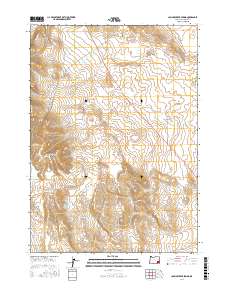
2017 Map of Johnny Creek Spring
USGS Topo · Published 2017About this map
The Sheepshead Mountains dominate the western landscape of this high desert region in Malheur County. The terrain is defined by volcanic features, most notably the Saddle Butte Lava Field and the prominent Cone Ridge to the south. Water sources are scarce but critical to the area, centered on the Johnny Creek Spring which feeds into Johnny Cr. To the north, the drainage network of Ryegrass Cr and the S Fork Ryegrass Cr carves through the undulating ground. Human presence is limited to remote access routes such as the N Fork Ryegrass Creek Rd, illustrating the isolated and topographical focus of this section of eastern Oregon.
Find a feature on this map
16 named features on this map. Tap any name to fly to it.
Don’t see what you’re looking for? This feature index may not catch every label — zoom into the map to look around manually.
Map Details
Editions of this 2017 Johnny Creek Spring Map
This is the sole edition of this map. No revisions or reprints were ever made.
Other maps of this area

1955 · Jordan Valley
USGS Topo · 1:250,000

1955 · Burns
USGS Topo · 1:250,000

1955 · Adel
USGS Topo · 1:250,000

1955 · Boise
USGS Topo · 1:250,000

1957 · Adel
USGS Topo · 1:250,000

1957 · Jordan Valley
USGS Topo · 1:250,000

1958 · Burns
USGS Topo · 1:250,000

1958 · Boise
USGS Topo · 1:250,000

1958 · Adel
USGS Topo · 1:250,000

1958 · Jordan Valley
USGS Topo · 1:250,000