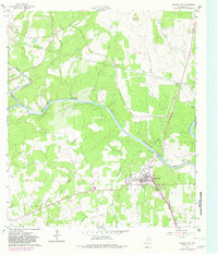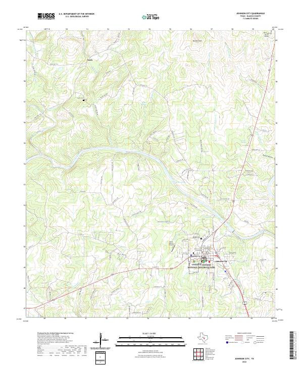
2022 Map of Johnson City
USGS Topo · Published 2022About this map
Lyndon B Johnson National Historical Park anchors the south-central portion of this Texas Hill Country landscape, preserving the legacy of the 36th President within his hometown of Johnson City. The town layout reflects its role as a regional hub, featuring the Blanco County Courthouses and several significant burial sites, including the Johnson City Masonic Cem, Johnson Cem, and the James Polk Johnson Cem. Northward, the settlement of Sandy sits near the Pedernales River, which winds through the center of the sheet.
Find a feature on this map
99 named features on this map. Tap any name to fly to it.
Don’t see what you’re looking for? This feature index may not catch every label — zoom into the map to look around manually.
Map Details
Editions of this 2022 Johnson City Map
This is the sole edition of this map. No revisions or reprints were ever made.