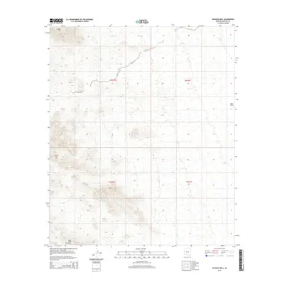
2014 Map of Johnson Well
USGS Topo · Published 2014About this map
Johnson Well serves as a primary landmark in this arid stretch of the Sonoran Desert, where topographic relief is defined by the significant elevations of the Sand Tank Mountains and Javelina Mtn. The landscape is characterized by its isolation and the deep drainages that cut through the desert floor, leading toward the broad expanse of the Vekol Valley. This 2014 survey captures a terrain where human infrastructure is sparse, centered largely around the namesake Johnson Well and a small network of trails and primitive roads. The inclusion of distinctive peaks like Squaw Tit highlights the dramatic verticality found within the desert mountain ranges, offering a detailed perspective of this specific corridor in Pinal and Maricopa counties. Researchers will find a clear representation of the region's natural hydrology and the historical importance of water sources in navigating this environment.
Find a feature on this map
9 named features on this map. Tap any name to fly to it.
Don’t see what you’re looking for? This feature index may not catch every label — zoom into the map to look around manually.
Map Details
Editions of this 2014 Johnson Well Map
This is the sole edition of this map. No revisions or reprints were ever made.
Other maps of this area

1941 · Vekol Mountains
USGS Topo · 1:62,500

1942 · Vekol Mountains
USGS Topo · 1:62,500

1946 · Antelope Peak
USGS Topo · 1:62,500

1948 · Antelope Peak
USGS Topo · 1:62,500

1951 · Estrella
USGS Topo · 1:62,500

1953 · Ajo
USGS Topo · 1:250,000

1957 · Ajo
USGS Topo · 1:250,000

1958 · Ajo
USGS Topo · 1:250,000

1958 · Kaka
USGS Topo · 1:62,500

1962 · Ajo
USGS Topo · 1:250,000