
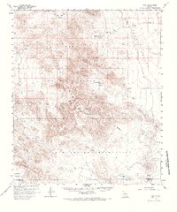
1958 Map of Kaka
USGS Topo · Published 1959About this map
The Papago Indian Reservation dominates the southern landscape of this 1958 survey, where the small settlement of Kaka sits at the edge of the Kaka Valley. The map reveals a land defined by water scarcity and strategic topography, with vital water sources like Moi Vaya Spring Well and Johnson Well serving as critical landmarks in an arid environment. To the north, the massive Luke-Williams Military Reservation occupies a significant portion of the Sand Tank Mountains, highlighting the area's mid-century transition to defense and training use.
Find a feature on this map
23 named features on this map. Tap any name to fly to it.
Don’t see what you’re looking for? This feature index may not catch every label — zoom into the map to look around manually.
Map Details
Editions of this 1958 Kaka Map
2 editions found
Other maps of this area

1941 · Vekol Mountains
USGS Topo · 1:62,500

1942 · Vekol Mountains
USGS Topo · 1:62,500

1946 · Antelope Peak
USGS Topo · 1:62,500

1948 · Antelope Peak
USGS Topo · 1:62,500

1951 · Estrella
USGS Topo · 1:62,500

1951 · Gila Bend
USGS Topo · 1:62,500

1953 · Ajo
USGS Topo · 1:250,000

1957 · Ajo
USGS Topo · 1:250,000

1958 · Ajo
USGS Topo · 1:250,000

1958 · Hat Mountain
USGS Topo · 1:62,500