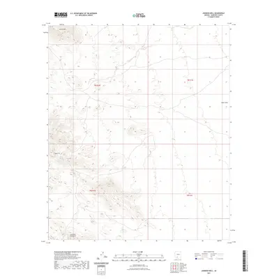
2021 Map of Johnson Well
USGS Topo · Published 2021About this map
Javelina Mtn and the Sand Tank Mountains define this arid landscape within the Sif Oidak District, marking a region characterized by dramatic elevation changes and desert basins. The survey captures the transition from high peaks to the broad expanse of Vekol Valley to the east. This area is predominantly defined by its natural topography rather than human settlement, with the landmark of Squaw Tit serving as a distinct navigational point in the western portion of the quadrangle. The land is organized by township boundaries including t8s r1w and t9s r1e, reflecting the structured grid system used to manage these desert reaches of Maricopa County. The lack of developed roads or named settlements emphasizes the character of the terrain during this 2021 update, where natural landforms remains the primary identifiers for the area.
Find a feature on this map
8 named features on this map. Tap any name to fly to it.
Don’t see what you’re looking for? This feature index may not catch every label — zoom into the map to look around manually.
Map Details
Editions of this 2021 Johnson Well Map
This is the sole edition of this map. No revisions or reprints were ever made.
Other maps of this area

1941 · Vekol Mountains
USGS Topo · 1:62,500

1942 · Vekol Mountains
USGS Topo · 1:62,500

1946 · Antelope Peak
USGS Topo · 1:62,500

1948 · Antelope Peak
USGS Topo · 1:62,500

1951 · Estrella
USGS Topo · 1:62,500

1953 · Ajo
USGS Topo · 1:250,000

1957 · Ajo
USGS Topo · 1:250,000

1958 · Ajo
USGS Topo · 1:250,000

1958 · Kaka
USGS Topo · 1:62,500

1962 · Ajo
USGS Topo · 1:250,000