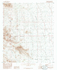
1986 Map of Johnson Well
USGS Topo · Published 1986About this map
Sand Tank Mountains dominate this 1980s landscape, their topographic contours carving through a high-desert environment defined by military and indigenous boundaries. The map marks the presence of Luke Air Force Range, which occupies a large portion of the central and western terrain, overlaying the natural features of the desert floor. This region serves as a convergence point for different land uses, where the southeastern portion of the map transitions into the Papago Indian Reservation.
Find a feature on this map
9 named features on this map. Tap any name to fly to it.
Don’t see what you’re looking for? This feature index may not catch every label — zoom into the map to look around manually.
Map Details
Editions of this 1986 Johnson Well Map
This is the sole edition of this map. No revisions or reprints were ever made.
Other maps of this area

1941 · Vekol Mountains
USGS Topo · 1:62,500

1942 · Vekol Mountains
USGS Topo · 1:62,500

1946 · Antelope Peak
USGS Topo · 1:62,500

1948 · Antelope Peak
USGS Topo · 1:62,500

1951 · Estrella
USGS Topo · 1:62,500

1953 · Ajo
USGS Topo · 1:250,000

1957 · Ajo
USGS Topo · 1:250,000

1958 · Ajo
USGS Topo · 1:250,000

1958 · Kaka
USGS Topo · 1:62,500

1962 · Ajo
USGS Topo · 1:250,000