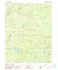
1991 Map of Jonesville
USGS Topo · Published 1991About this map
Jonesville sits at the high elevations of the northern Sierra Nevada, serving as a focal point for the mountain landscape of the Lassen National Forest. The 1990s terrain is characterized by a network of seasonal camps and recreational outposts, such as Dresser Camp and Butte Creek House, connected by rugged paths including the Pacific Crest National Scenic Trail. The hydrography of the region is dominated by Philbrook Reservoir and several high-altitude lakes like Snag Lake and Lotts Lake, which feed the West Branch Feather River.
Find a feature on this map
43 named features on this map. Tap any name to fly to it.
Don’t see what you’re looking for? This feature index may not catch every label — zoom into the map to look around manually.
Map Details
Editions of this 1991 Jonesville Map
This is the sole edition of this map. No revisions or reprints were ever made.
Other maps of this area

1886 · Lassen Peak
USGS Topo · 1:250,000

1888 · Bidwell Bar
USGS Topo · 1:125,000

1891 · Bidwell Bar
USGS Topo · 1:125,000

1891 · Chico
USGS Topo · 1:125,000

1892 · Lassen Peak
USGS Topo · 1:250,000

1893 · Chico
USGS Topo · 1:125,000

1893 · Bidwell Bar
USGS Topo · 1:125,000

1894 · Lassen Peak
USGS Topo · 1:250,000

1895 · Bidwell Bar
USGS Topo · 1:125,000

1895 · Chico
USGS Topo · 1:125,000