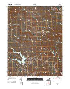
2010 Map of Joplin
USGS Topo · Published 2010About this map
The training grounds and woodland settlements of northern Virginia define this area as it appeared in the early 21st century. The map centers on the diverse waterways of the Quantico Creek and Chopawamsic Creek systems, including the complex forks of the North Branch Chopawamsic Creek and South Branch Chopawamsic Creek. These water resources are managed by structures such as the Lunga Dam and Breckinridge Dam, which created the Lunga Reservoir and Breckinridge Reservoir.
Find a feature on this map
34 named features on this map. Tap any name to fly to it.
Don’t see what you’re looking for? This feature index may not catch every label — zoom into the map to look around manually.
Map Details
Editions of this 2010 Joplin Map
This is the sole edition of this map. No revisions or reprints were ever made.
Other maps of this area

1887 · Spottsylvania
USGS Topo · 1:125,000

1889 · Fredericksburg
USGS Topo · 1:125,000

1890 · Mt. Vernon
USGS Topo · 1:125,000

1891 · Mt. Vernon
USGS Topo · 1:125,000

1892 · Fredericksburg
USGS Topo · 1:125,000

1892 · Spottsylvania
USGS Topo · 1:125,000

1894 · Warrenton
USGS Topo · 1:125,000

1894 · Fredericksburg
USGS Topo · 1:125,000

1894 · Mt. Vernon
USGS Topo · 1:125,000

1897 · Mt. Vernon
USGS Topo · 1:125,000