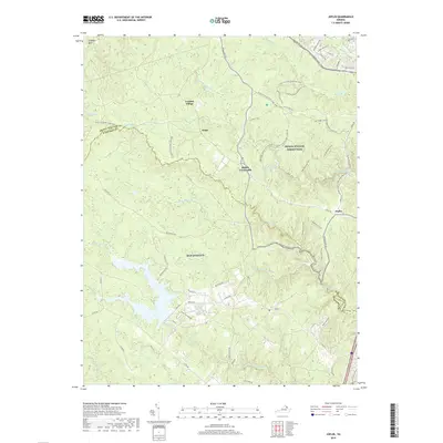
2019 Map of Joplin
USGS Topo · Published 2019About this map
Prince William Forest Park and the sprawling training grounds of MCB Quantico dominate this landscape on the border of Prince William and Stafford Counties. The map reveals a transition from the preserved woodlands of the forest park to the active military installations of the Quantico Marine Corps Base, including specialized areas like Combat Village. Historically significant crossroads and small settlements such as Joplin, Belfair Crossroads, and Kopp are situated along winding routes like Joplin Rd. The terrain is defined by the complex drainage systems of Quantico Cr and the S Br Chopawamsic Cr, alongside the geological feature of the Culpeper Basin. This modern survey documents the extensive trail network within the park, featuring the Farms to Forest Trail and S Valley Trail, which trace the path of earlier rural land use before the establishment of the federal reservation.
Find a feature on this map
68 named features on this map. Tap any name to fly to it.
Don’t see what you’re looking for? This feature index may not catch every label — zoom into the map to look around manually.
Map Details
Editions of this 2019 Joplin Map
This is the sole edition of this map. No revisions or reprints were ever made.
Other maps of this area

1887 · Spottsylvania
USGS Topo · 1:125,000

1889 · Fredericksburg
USGS Topo · 1:125,000

1890 · Mt. Vernon
USGS Topo · 1:125,000

1891 · Mt. Vernon
USGS Topo · 1:125,000

1892 · Fredericksburg
USGS Topo · 1:125,000

1892 · Spottsylvania
USGS Topo · 1:125,000

1894 · Warrenton
USGS Topo · 1:125,000

1894 · Fredericksburg
USGS Topo · 1:125,000

1894 · Mt. Vernon
USGS Topo · 1:125,000

1897 · Mt. Vernon
USGS Topo · 1:125,000