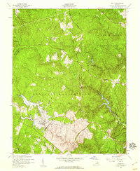
1957 Map of Joplin
USGS Topo · Published 1959About this map
The Prince William Forest Park dominates this mid-century landscape, a heavily wooded terrain shaped by the tributaries of Quantico Creek. This era of the late 1950s captures the transition of the land into military and recreational use, with the Quantico Marine Base boundary running through the southern half of the quadrangle. A significant geographic detail is the designation of the Lunga Reservoir (Proposed) along Beaverdam Run, indicating planned water management that would soon alter the hydrology of the area. Small pockets of private history remain visible in the small settlements of Kopp and Joplin, alongside scattered Cem sites and established recreational facilities such as Camp No 2 and Camp No 5. The map provides a detailed view of the drainage patterns of Chopawamsic Creek and its various branches as they move through the heavily dissected topography of the Stafford and Prince William county line.
Find a feature on this map
22 named features on this map. Tap any name to fly to it.
Don’t see what you’re looking for? This feature index may not catch every label — zoom into the map to look around manually.
Map Details
Editions of this 1957 Joplin Map
This is the sole edition of this map. No revisions or reprints were ever made.
Other maps of this area

1887 · Spottsylvania
USGS Topo · 1:125,000

1889 · Fredericksburg
USGS Topo · 1:125,000

1890 · Mt. Vernon
USGS Topo · 1:125,000

1891 · Mt. Vernon
USGS Topo · 1:125,000

1892 · Fredericksburg
USGS Topo · 1:125,000

1892 · Spottsylvania
USGS Topo · 1:125,000

1894 · Warrenton
USGS Topo · 1:125,000

1894 · Fredericksburg
USGS Topo · 1:125,000

1894 · Mt. Vernon
USGS Topo · 1:125,000

1897 · Mt. Vernon
USGS Topo · 1:125,000