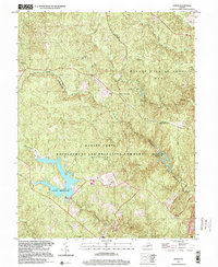
1997 Map of Joplin
USGS Topo · Published 2000About this map
Marine Corps Development and Education Command (Quantico) dominates the southern portion of this landscape, where specialized training facilities like Combat Village sit near the extensive waters of Lunga Reservoir. To the north, the terrain transitions into the protected forest of Prince William Forest Park, characterized by a network of recreational sites including Oak Ridge Campground, Mawavi Camp No 2, and Happyland Camp No 5.
Find a feature on this map
29 named features on this map. Tap any name to fly to it.
Don’t see what you’re looking for? This feature index may not catch every label — zoom into the map to look around manually.
Map Details
Editions of this 1997 Joplin Map
This is the sole edition of this map. No revisions or reprints were ever made.
Other maps of this area

1887 · Spottsylvania
USGS Topo · 1:125,000

1889 · Fredericksburg
USGS Topo · 1:125,000

1890 · Mt. Vernon
USGS Topo · 1:125,000

1891 · Mt. Vernon
USGS Topo · 1:125,000

1892 · Fredericksburg
USGS Topo · 1:125,000

1892 · Spottsylvania
USGS Topo · 1:125,000

1894 · Warrenton
USGS Topo · 1:125,000

1894 · Fredericksburg
USGS Topo · 1:125,000

1894 · Mt. Vernon
USGS Topo · 1:125,000

1897 · Mt. Vernon
USGS Topo · 1:125,000