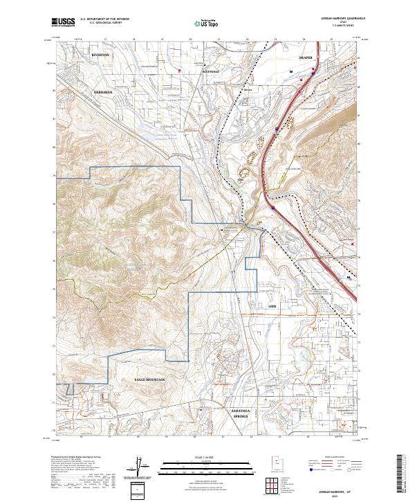
2023 Map of Jordan Narrows
USGS Topo · Published 2023About this map
The Jordan River carves a critical path through the Traverse Mountains on this survey, marking the geographic transition between the Salt Lake Valley and its southern neighbors. This corridor is defined by an intricate network of water infrastructure, including the Utah and Salt Lake Canal, the Provo Reservoir Canal, and the East Jordan Canal, which illustrate the long-standing irrigation efforts required to support the rapid development of Bluffdale, Riverton, and Draper. The map shows a landscape of intensive land use, ranging from the military grounds of NG MTA L Camp Williams to the commercial and educational hub at the Mountainland Applied Technology College. Highlighting the area's role as a regional crossroads, the survey details the steep ascent of the Point of the Mtn and the numerous recreation and transit corridors, such as the Lehi Rail Trail-Comm Trl and the Jordon River Pkwy Trl.
Find a feature on this map
114 named features on this map. Tap any name to fly to it.
Don’t see what you’re looking for? This feature index may not catch every label — zoom into the map to look around manually.
Map Details
Editions of this 2023 Jordan Narrows Map
This is the sole edition of this map. No revisions or reprints were ever made.
Other maps of this area

1885 · Salt Lake
USGS Topo · 1:250,000

1885 · Tooele Valley
USGS Topo · 1:250,000

1915 · Fairfield
USGS Topo · 1:62,500

1917 · Fairfield
USGS Topo · 1:62,500

1925 · Ft. Douglas
USGS Topo · 1:125,000

1928 · Ft. Douglas
USGS Topo · 1:125,000

1950 · Pelican Point
USGS Topo · 1:24,000
1951 · Pelican Point
USGS Topo · 1:24,000

1951 · Jordan Narrows
USGS Topo · 1:24,000
1951 · Saratoga Springs
USGS Topo · 1:24,000