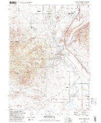
1993 Map of Jordan Narrows
USGS Topo · Published 1993About this map
The Jordan River cuts through the narrow gap between the Traverse Mountains in this early 1990s record of a landscape defined by water management and military presence. Industrial and agricultural infrastructure is prominent, with the Provo Reservoir Canal, Salt Lake City Aqueduct, and Utah Lake Distributing Canal following the terrain's contours to support the growing communities of Bluffdale and Olivers. Historically significant landmarks include the Rockwell Station Pony Express Historical Marker near the Utah State Prison and the extensive Camp Williams Military Reservation, which dominates the southwestern highlands. The map also captures the recreational and civic character of the area through Willow Park, the Mountain Valley Elementary School, and the Bluffdale Cemetery.
Find a feature on this map
72 named features on this map. Tap any name to fly to it.
Don’t see what you’re looking for? This feature index may not catch every label — zoom into the map to look around manually.
Map Details
Editions of this 1993 Jordan Narrows Map
This is the sole edition of this map. No revisions or reprints were ever made.
Other maps of this area

1885 · Salt Lake
USGS Topo · 1:250,000

1885 · Tooele Valley
USGS Topo · 1:250,000

1915 · Fairfield
USGS Topo · 1:62,500

1917 · Fairfield
USGS Topo · 1:62,500

1925 · Ft. Douglas
USGS Topo · 1:125,000

1928 · Ft. Douglas
USGS Topo · 1:125,000

1950 · Pelican Point
USGS Topo · 1:24,000
1951 · Pelican Point
USGS Topo · 1:24,000

1951 · Jordan Narrows
USGS Topo · 1:24,000
1951 · Saratoga Springs
USGS Topo · 1:24,000